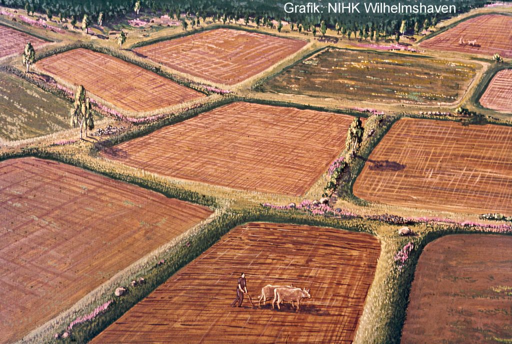
If you look very closely, you can make out numerous low earthen banks here in the forest between Wohlde and Bergenhusen. These are about 2-3 m wide, 20 cm high at most and positioned in small chequered, more or less rectangular areas. These are the remains of fields where Iron Age farmers cultivated their grain a little more than 2000 years ago. Such adjoining arable fields are called “celtic fields” for historical reasons. However, this type of field pattern does not necessarily have anything to do with the Celts, but was found throughout north western Europe from the late Bronze Age to the age of the Roman Empire.
The walls around the fields were formed using dead tree roots, stones and weeds. The ploughing technique of the time also determined the shape of the fields: in the beginning, a hook plough was used to plough crosswise, which resulted in more or less square fields. Fields dating from later, are relatively long and narrow, as they were most likely only ploughed in one direction. A plough was probably already used here to turn the clods.
It is rare that whole plots of such field walls have been preserved as they have been here in Bergenhusen. This indicates that the areas here quickly became overgrown with forests or heath again after their use and were also no longer used for agriculture. This is therefore an exceptionally important prehistoric national monument, which is well worth preserving and visiting.
We must be careful not to confuse these with the many clearly identifiable, higher and narrower earthen walls that also cut through the forest, which are in fact much more recent field boundaries: These are former hedgerows (in German called “Knicks”) erected by hand in the course of the consolidation of land by royal decree around the year 1800 in order to divide the fields and provide timber.
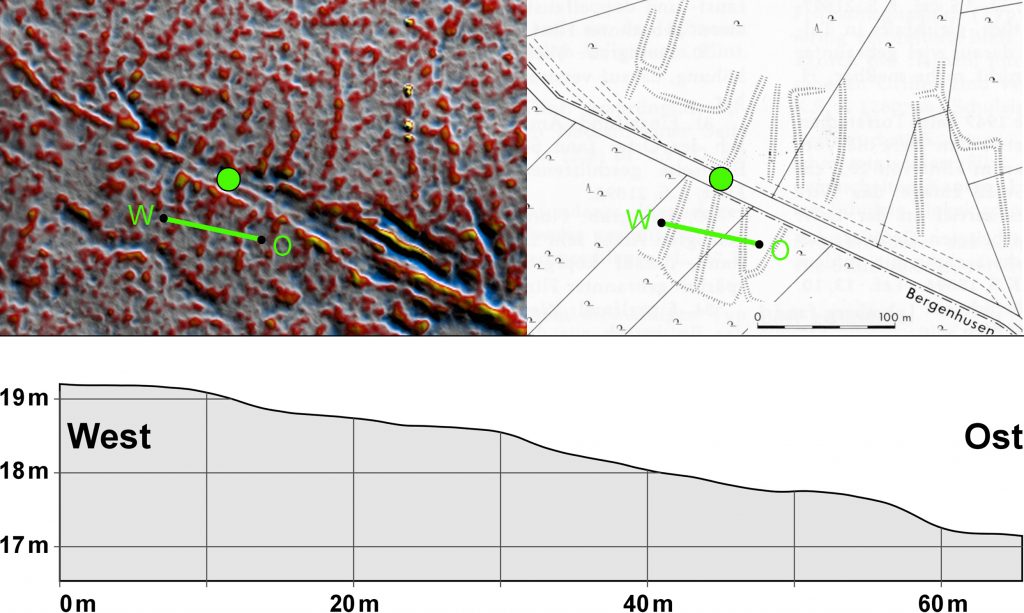
Below: Cross-section of three ramparts of prehistoric farmland in 5-fold elevation – © V. Arnold
For more information, visit http://celtic-fields.com (German website).